Tuesday 30 April 2024

2024 Walking South Pembrokeshire - Day 6

Tuesday 30 April

East Angle to Pembroke

Another soggy day in my home county, Pembrokeshire. Not exactly the dry, balmy weather I'd hoped for but crack on soldier!! Despite the deluge I knew that today was going to be nostalgic as I'd be walking beside many childhood memories. As a family, when I was growing up, our special days were Sundays, the only day my dad had off from work. In the summer we spent it on the river in our 15ft, clinker-built, ex-Navy/RAF tender which was powered by a noisy outboard engine. Depending on the tide times we'd either go up-river or, better still, down to Angle to swim and picnic at West Angle Bay or go cockling off the boat, on the mudflats, at low tide. Very Swallows & Amazons!! The sun always seemed to shine in my memory!! In the other seasons we walked the abundant quiet lanes, picking blackberries and sloes or foraging for mushrooms. Sometimes we even found the odd pheasant snared by some poacher - we had been known to release the poor, dead creature (& later eat it, roasted!!) This was the setting for today's walk.

My starting point was East Angle Bay. 

So eager was I to start that I forgot to switch on my gizmos or get Denise to get out of the car (in the pouring rain) and take a start photo. Needless to say, she didn't remind me!! 

I'd walked almost a mile before I remembered to switch on & take a photo! 

At this time I'd been sheltered by trees but, as I carried on I decided to use my umbrella to keep the worst of the rain off. 

Fortunately the wind was a mere puff compared to yesterday. 

My route took me all the way round the edge of the bay, not particularly to report other than the incongruity of the massive Valero Oil Refinery dominating the skyline. I felt and still feel sorry for the residents of Rhoscrowther and Pwllcrochan; the installation was large when first built when I was a young teenager - it has grown even larger since then. 


As I walked past Sawdern Point I turned and took a picture of my Start Point (see green arrow)

Angle village, Angle Point and the lifeboat station are barely visible in the rain and mist. As for a view down the haven of the Stack Rock Fort and Dale Fort on the northern shore at the mouth of the haven, they were shrouded in a cloak of mist.

I walked on towards Popton Fort which was completed in 1864 as part of the inner line of defence of Milford Haven. It has tapering hexagonal ramparts with pentagonal bastions at the angles. It is surrounded by a large clear area of sloping ground to the front, and a ditch on the south side. It comprised two batteries, Moncrieff Battery on the west side and Open Battery on the north. It was abandoned at the start of the 20th century it was used again by the military during the Second World War. It was ought in 1957 by BP to be used as an oil terminal & was renovated but was closed to the public. It is now part of Valero's Angle Bay Refinery & still closed to the public. 

I climbed the steep road on the northern side of the fort and then headed down the Coastal Footpath with the Haven on my left and the Refinery on my right. I had to pause at the top whilst I was "interviewed" by Richard Hatch of BFBS Afternoon. This picture was my view! I think that my interviews (3 so far) have gone out at around 1330hrs on Thu 25th, Fri 26th and today. On all 3 interviews I have tried to plug the WRAC Association being free to join but know it's been edited out at least once!! I'm going to try and put a link and see if it works!!  It will take you to a new page.

https://radio.bfbs.com/catchup/bfbs-afternoon


After the interview I headed down the path and yes, it went down, to go up, to come down, . . . you get the idea. 


Nostalgia hit me as I came upon Bulwell Bay. I well remember as a child/youth mooring in or near the bay at low tide and squelching around in the mud picking cockles. You could feel them with your toes so could then bend down, pick them up, give them a bit of a wash and throw them in a bucket. We'd take them home, let them soak in salt water for a day or so to clean them and then cook & eat them!! Yummy, especially when bottled in vinegar.

I'd taken the coastal path that skirted round the refinery. The going was ok, a little soggy 
underfoot with some smallish puddles and a little slippery descending and climbing so I had to take care. I was quite pleased then to be finished with the jetties as I made my way under the pipelines carrying the fuel to the refinery. I took a photo of Pembroke Dock, some way up-river shrouded in mist and rain like everything else. Then I started to ascend again, walking up towards the fields above the treeline.


Just when I thought it was safe and I was out of the soggy path I ended up in the mire!! 

I laughed it off. 

"Oh well, never mind", I thought, "I'll soon be walking on a nice grassy field"

Well, you know what thought did? 

It found me some cattle!! 

Thanks to the rain the sloping field that they were grazing was a more a sloping lake. They had obviously trampled around quite a bit and churned the ground up quite badly all over the field. They ignored me and I ignored them from behind my umbrella!! All I had to do was exit the field and find my next prehistoric fortification. Both proved difficult. This was the gate I had just come through and the fortification was through another, equally muddy, gateway to my right! I decided the fortification could go un-bagged!!


I made my way down the muddy lane to Rhoscrowther church with the view of the refinery burning off excess gas!!

Blot on the Landscape springs to mind. 

I guess this is the price we pay for our modern conveniences!!

The next bit of my walk I decided to keep to the road and not dice with mud-baths on the coastal path. As I was walking southwards up onto the ridge again the wind, such as it was, was full in my face and the rain was battering me. 

At the top of the ridge I headed eastwards along a very minor road. The road undulated and became a typical quiet Pembrokeshire lane with high banks topped with hedging and surrounded by woodland each time it dipped down towards sea-level. 

The wild flowers were stunning and I saw my first wild orchid of the year.


Each time I crested the ridges I was rewarded with panoramic views. 

I even saw the P&O ferry as she made her way up haven to Pembroke Dock. 

Bet it wasn't much of a pleasure cruise yesterday!!

I didn't stop for anything to eat for a couple of reasons; firstly it was raining so nowhere dry to to sit (or even stand), secondly, with all the waterproof coverings, umbrella etc to cope with it was just too much trouble to unpack my sandwiches!!

Before I knew it I had passed Monkton Priory and was making my way towards Pembroke Castle. 

This spectacular and forbidding castle was the home of the earls of Pembroke for over 300 years and the birthplace of Henry VII, the first Tudor king. 

Most of the present buildings date from the 13th century. The oldest part of the complex is the looming keep, dating to 1204. Next to the keep is the Dungeon Tower, where you can peer into a dank, dark prison cell. 

Nearby, with access through the Northern Hall, are steps to Wogan Cavern, a large natural cave that was partially walled in by the Normans and probably used as a store and boathouse. 

According to research carried out in 2022 the cave was occupied by residents as far back as the Palaeolithic and Mesolithic Periods

In the room in which he is believed to have been born, in 1457, a tableau commemorates Henry Tudor (Harri Tudur), who defeated Richard III at the Battle of Bosworth Field in 1485 to become Henry VII.


You can support me and my two charities by clicking on the link below which will take you to my fundraising page at Give as you Live Donate:

My thanks to everyone who has so generously donated. Your money will be well used by both my charities.

Monday 29 April 2024

2024 Walking South Pembrokeshire - Day 5

Monday 29th April

Castlemartin to Angle

Wow! What a busy day I've had!! Last night we took one look at the weather forecast and knew that today was going to be interesting to say the least. Wind and rain were on the cards and boy! did they turn up!!

Although we set off from Castlemartin towards Freshwater West it soon became apparent that the wind was far stronger than we thought. We had set off fairly early to do as much of the walk as I could before the rain started. I abandoned the first part of the walk as it was only on the rather boring road; I had to be in Pembroke Dock for 11am so time was limited. 

So busy was I re-planning the day's walk that I forgot to get Denise to stop the car so I could take photos at Freshwater West Memorial, this one is a stock photo. The memorial cross, situated on the north western headland overlooking Freshwater West Bay, commemorates the sinking of LCG 15 and LCG 16 a pair of ‘Landing Craft, Gun’, swamped and sunk in a severe storm en route from the H&W Yard, Belfast to Falmouth. The tragedy took place on the night of 25/26th April 1943 with the loss of 85 lives. Most of the victims were from the LCG’s but also included 6 crew from the fisheries protection vessel, HMS Rosemary, who attempted a rescue using their ship’s lifeboat.  


I decided to try and "Bag" the first 2 forts on my list, the 1st at West Pickard Bay, the 2nd at Whitedole Bay near Sheep Island. As the wind was blowing at around a Force 8 and gusting to Force 9 I decided that it would be a tad unwise to attempt the Coastal Path so the plan was for Denise to drop me off on the road leading to Angle. There were a few points where I hoped, looking at the map, I would be able to get to or near the prehistoric sites. The first stop looked quite promising. The Photo shows how the wind was whipping my backpack cover to one side. I waved Denise goodbye and headed south across the headland towards the coastal path. The wind was very strong and a little gusty which made progress a bit stilted, however, at least it wasn't raining, more a heavy mist. 


I came to a gate and, looking across the fields, could see two 'lumps' which could have been the remains of the camp - the red arrow points at them!! I also saw a sizeable herd of cattle!! I'm not keen on cattle - too inquisitive, too big & unpredictable!! So, not that. approach. 

I skirted round to the left down another track but sadly that ended up in a ploughed field edged by a barbed-wire fence and thick, thorny hedge.


I clambered up a grassy mound and took a photo and nearly got blown over for my pains! One fort "bagged" - well, sort of!

So back to the road and onward to point two where I thought I might be able to access the 2nd fort. On the way I came across a fox heading towards me. I saw him before he saw me so I stopped as he trotted happily towards me. Just as I was about to take a photo a car drove past me and frightened the fox away. 


Sadly the track, when I came to it, was horribly overgrown. 

I attempted to negotiate it but had to abandon and return to the road passing several old carcasses, probably of lambs, which might have been the reason the bold fox was on the prowl. 

So, no "Bag" number 2.

Once on the road I was then heading for the 3rd and last means of reaching the sites. This time it included the East Blockhouse, constructed on Henry VIII's orders to protect the entrance to the haven. It is the earliest military site around the haven but is sadly falling into the sea with coastal erosion.


Imagine my surprise (& fear!) when, carrying on up the road I came across a small herd of young cattle. They had obviously got out of their field several miles back because I had been avoiding their fresh poo splatters all the way! I think they were even more upset than I as I gently followed them up the road towards East Blockhouse. 

When we got to the end of the road it was a dead-end for them because of a cattle grid. Fortunately there was enough room for me to squeeze gently past them as they skipped off back the way they'd come.


Sadly I was never going to reach the East Blockhouse. I was now on the highest part of the headland ridge and the wind was now definitely getting worse, probably around Force 9. I would have had to head into the teeth of the storm and I didn't feel safe enough to do that. Instead, I cut my losses and headed down the footpath to West Angle Bay where Denise was waiting for me.


We now had to head for Pembroke Dock by car as I was due to meet fellow veterans at the VC Gallery for Naafi Break at 1100hrs!! 

Wow! What a reception we got. Steph, the manager, was there to greet us with a very warm welcome. We met so many wonderful people and spent far longer there than we should have. I met people who had known my family, folk from 22LtAD Regt, RA where I had been Assistant Adjutant (many years previously), the grandson of the lady who made or altered most of my clothes (I was a very tall, very skinny kid!!), a member of my late aunts school choir and all the volunteers and staff who make the place the VC Gallery the vibrant, positive place that it is. 

Steph gave us a guided tour of the facility which offers so much to veterans and the community in general. My hat off to Barry John, MBE, an ex-RRW veteran who used his Army severance pay to fund the first of these wonderful places. The charity now runs two centres, both in Pembrokeshire and, as one of the volunteers said, "If only these could be rolled out throughout Wales, what a difference they would make" I wholeheartedly agree. 

I was fortunate enough to meet up with Colonel James Phillips, The Veterans' Commissioner for Wales. It was great to find out how things are being done for veterans here in Wales. James is really easy to talk to, we had a good chat and it was lovely of him to give of his time to meet up with little old me. (Photos to follow as neither Denise,  myself or James took any!)

I gobbled up a plateful (or two) of the delicious buffet the VC Gallery had put on (they admitted it was left over from a function this weekend!!) The KFC-style chicken and pasta salad hit the spot! But. . . . . . I still had a walk to complete. Denise, bless her, drove me back to West Angle Bay again to restart where I'd left off.

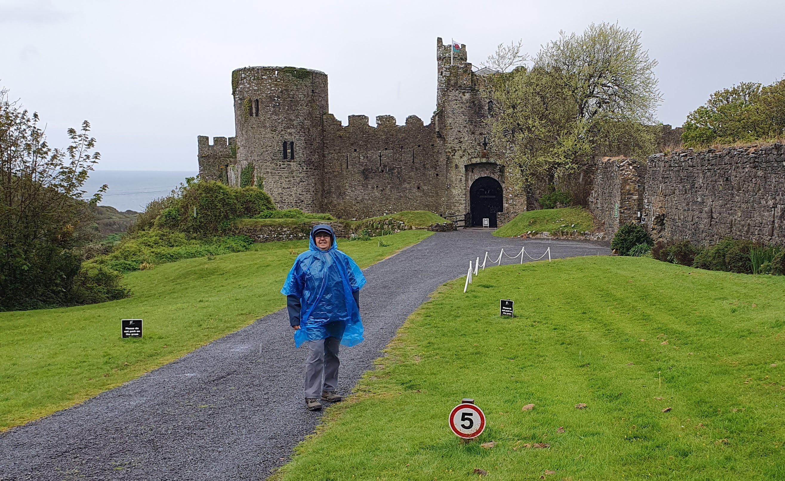
Somewhere on that headland is East Blockhouse


If anything the weather had got worse. It was still blowing about Force 9 but now the rain was also lashing down. I headed out of the car park along the Coastal Path. Denise drove to the other end of the village to await my arrival as I walked the peninsula. I got as close as I could to Thorn Island Fort, a the wind and rain battering me. The Thorn Island Battery was built during 1852-4 to provide the first forward defence for the Haven waterway, coupled with West Blockhouse, Dale and Stack Rock forts. 


I was stopped on my way to Thorn Island, not only by the wind on the exposed pathway but, by the massive muddy bog that 'blocked' my way!! Turning back was the only solution. 

I had to continue back along the road and turn left up to the ridge towards Chapel Bay Fort. 

Chapel Bay, one of a series of forts built as part of the inner line of defence of the Haven following the Royal Commission on the Defence of the United Kingdom, it is a Grade II Listed Building and is also known as Chapel Bay Battery. Construction began in 1890, and was completed in 1891. The battery was the first fortification in the area to be built of mass concrete. It could accommodate 91 men, and had a mess room and sick bay facilities. Its initial armament was three ten inch rifled muzzle-loading guns. There were twelve forts constructed to protect the Haven and Royal Dockyards. 


I was fortunately blown up the road to the Fort and was so relieved to have got there that I forgot to take a photo till I was past it!


The remaining walk was just on the leeward side of the ridge so was a little easier. it was, however, through woodland and I was a bit concerned that the storm might bring down some debris. so, I joggled a bit, just to get out from under the hazard!! 


I should have had interesting views of the haven but it kept disappearing in the rain!! 


I passed the Lifeboat Station and was able to see Stack Rock Fort in the middle of the Haven and the jetties of South Hook Gas Terminal and Valero Oil Refinery. 

It was then a quick dash over the brow of the hill, back into the wind and rain. From Café Mor at the Pointhouse it was another soggy joggle along the shingle track back towards the village. 


Before my walk was done I had one more fortification to "Bag". Angle Tower was constructed in the 14th century by the Shirburn family. With 3 foot thick walls, a drawbridge and a moat, it had enough fortification for the family to feel a moderate sense of safety if threatened, particularly by seaborne raiders. It is thought to be the only Peel (Pele) Tower in Wales.


Time to strip off my wet outer garments and get back in the car for our journey back to our accommodation. Poor Denise, she complained that she had a square bottom for all the sitting around she had to do today!!


I've no idea how far I've walked today - my App went bonkers!! According to it I've completed 11.45 miles but it did something weird so I'm not sure. I think the 9.7mph must have been when I apparently zoomed across the haven!!


Another day done. Hopefully tomorrow will be a little less hectic & traumatic. I'm being interviewed again by Richard Hatch on BFBS Afternoon tomorrow at around 1.30pm (Tuesday)


If you would like to sponsor me and my two amazing charities please follow the link: https://donate.giveasyoulive.com/fundraising/margs-pembrokeshire-100-mile-2024

Sunday 28 April 2024

2024 Walking South Pembrokeshire - Day 4

Sunday 28th April 

Bosherston to Castlemartin via St Govan's & Stack Rocks

Today there were 6 fortifications to "Bag" as well as some rather spectacular natural features.


From Bosherston village I headed for St Govan's Chapel, the legendary home of a monk, St Govan, who supposedly hid from pirates in a cleft in the rock - the impression of his ribcage can still be seen!! 

As there are possibly 52 steps down I chose to give it a miss today.


Moving swiftly on!! I set out across the clifftops along the ancient wave-cut platform that is now used primarily as a Military Firing Range.

Yesterday the forecast had been for light breeze from the east and lots of sunshine. Definitely no rain, not even mizzle till around 2pm! 

Huh! They lied!! I started off in a blustery westerly, straight in the face and an overcast, threatening sky. However, the scenery made up for it. 


At Bosherston Mere, a little way to the west of the chapel are two spectacular chasms. I took a photo of the 1st but not the 2nd, so called "Huntsman's Leap," where legend had it that a huntsman chasing a fox jumped the gap. This so frightened him when he realised what he'd done that he fell off his horse & died!! 


With all this spectacular beauty to my left the view of Military Target Vehicles to my right seemed a little incongruous. 

The area was first used by the military in 1939 and was purchased in 1948. It is still used today with live firing on week days when the range is closed. 

Just as well my walk here was at the weekend!!


My first prehistoric fort was hardly visible. 

The next, Buckspool Down or Castle Fort was slightly more visible as a series of raised ridges near a range lookout station. It was about here that it started to rain and I had to don my skimpy blue poncho.


Evidence of earlier military activity was all around. Shell or shrapnel 'scrapes' in the turf where something had hit and gouged a furrow. The range wardens must spend a lot of their time collecting the debris as it is a much used and loved recreational area. 

There were also the remains of structures that I remembered from my youth as far less overgrown. 


Onward past Bullslaughter Bay to the remains of a fort that allegedly is there but I believe is so overgrown that I couldn't see it. 

The Crocksydam Promontory fort that I saw was nothing like the one on the information post. 

Maybe because I wasn't brave enough to get close enough to the edge to take the necessary photo!!

I carried on walking and was now able to take off my fetching but noisy poncho. The sun even threatened to shine!


The next fort was at Flimston Bay. 
Both this and Crocksydam forts were probably erected sometime between 600 BC and 43 AD. Flimston fort is defended by a series of three earthen banks and ditches on the landward side, enclosing a fairly large area. On the eastern side of the fort interior are a number of shallow hollows that may represent platforms for supporting huts.


Stack Rocks and the Green Bridge of Wales were the next features to snap. 

The Rocks were crammed with Razorbills and Guillemots (known locally as Elegugs). Even with the wind blowing the sound away from me they certainly made a bit of a racket. 

Not only were they on the rocks there were also flocks of them floating about on the water.

I carried on past Stack Rocks and on to view the Green Bridge of Wales. Probably, as it is such a photogenic structure, the authorities decided to build a fenced wooden platform from where one could take the perfect picture without plummeting over the cliff edge! I duly obliged!


I then headed north, away from the firing range and up towards the west/east ridge that extends from Freshwater West to Freshwater East. Once part of the way up I had to take a long detour to bag my penultimate fort, Merion Camp. In my mind Merion Camp is the military  firing range and Training Barracks on the range. I never knew of the existence of another, earlier structure up on the ridge behind the barracks. There it was, behind a huge bank and hedge, I could see nothing!


So much for my two mile detour. 

I had to carry on eastwards until I could take the road back westwards towards my final destination, Castlemartin. 

To make matters worse, it started to rain again, only a bit of a shower but annoying none the less. 

Imagine my surprise (& delight) when I realised I could see the missing fort much better from this side!

That put a spring in my step to cover the last few of miles to Castlemartin. Unfortunately there was another disappointment as the castle "mound," that appears quite extensive on the map, is a bit of a flat field hidden away behind private houses and high hedges.


I contented myself with a photo of the Cattle Pound that is now used as a roundabout.

The "castle" is behind the hedge on the left.

I also visited the plot of land which had been owned by my  grandfather's family several generations ago!

Another walk completed and another 11.5 miles covered. Halfway through the walk and I've covered around 49 miles. Anyone would think it was planned!!

If you would like to sponsor me just click on the link below which will take you to my fundraising page at Give as you Live Donate:

https://donate.giveasyoulive.com/fundraising/margs-pembrokeshire-100-mile-2024

I also believe that the Milford Mercury has covered my story. The link is below:

https://www.milfordmercury.co.uk/news/24278737.pembroke-dock-veteran-72-sets-off-100-mile-solo-walk/


Saturday 27 April 2024

2024 Walking South Pembrokeshire - Day 3

Saturday 27th April

Manorbier to Bosherston via Freshwater East and Stackpole Quay

Only once before on my 10 previous walks have I had to contend with such rain!! We woke up today to fairly heavy rain and a bit of a blow from the east. Still, I couldn't let a drop of rain stop play!! 

We arrived at Manorbier castle where it was still raining so waterproof jacket plus a very lightweight, fetching, blue 'poncho' was dress-order for this walk. The castle was the birthplace of Giraldus Cambrensis (Gerald of Wales; 1146–1223), one of Wales's greatest scholars and patriots. Initially it was a motte-and-bailey castle which had a wooden keep defended by a palisade and earthworks embankments. In the early part of the 12th century, William de Barri used locally quarried Limestone to strengthen the fortification. 

 I think the Number 5 sign refers to the Mental Age of anyone mad enough to walk on a morning like this!!


The rain stayed with me down to near the beach and back up beside what I used to know (in my childhood - many moons ago) as the Dak Café. I think its a private house now. This was where a decision had to be made. Take the Coastal Path or the road? I decided that, given the weather, the rough terrain, my less than youthful legs plus my newly discovered "Old Codgers!" sense of unbalance, I had better stick to the road. 


It was, for the most part a fairly quiet, narrow tarmac 'track' rather than road. The route followed the kind of Pembrokeshire lane that terrifies most tourists given its narrow, high-banked, twisting nature. 


As I climbed back up, heading for Freshwater East, I could admire the view and the ever lightening sky. 

Maybe the rain would ease? 

I could but hope.


The going was good if a little wet and muddy and I was soon at the start of 
Freshwater East. 

Down the hill to the Park where our chalet is situated and then back up the lane to Trewent and onwards to Stackpole Quay. 

I had thought to bag another Iron Age Fortified Promontory Fort between Trewent Point and Stackpole Quay. 

Even though I wasn't on the Coastal Path I thought I could get to it down a farm track; the farmer had other ideas. 


A barbed-wire wrapped gate with a heavy locked chain proved my undoing!! 


Soon I was heading down to Stackpole Quay which is probably one of my favourite swimming spots locally. There is a small quay in a little cove carved out by limestone quarrying in the past. When the tide is in it proves the ideal swimming pool; calm, sunny (when it's shining!) and usually child/dog free. 

The 'masses' head for Barafundle Bay in the summer which, when I was young, would be blissfully people-free even in the height of the season! People generally didn't walk back then (in the Dark Ages!!)
I met up with Denise in the NT café and we had an excellent cup of coffee each & I had the obligatory Bacon Roll!!


From there it was across the fields to Bosherston Lily Ponds on the NT property that was Stackpole Court. I wanted to visit because it tied in with the first day of my Scotland walk in 2022 when I roamed around Cawdor Estate woodland. 

The Cawdor's owned and lived at Stackpole Court after marrying a 'local' girl. They were mainly responsible for extending the Lily Ponds, a playground for the rich & landed gentry. 


The Court was requisitioned during the War and, according to local legend, was so badly trashed that the Cawdor's decided to demolish rather than refurbish the main house. 


I think it more likely that it was demolished to avoid Death Duties on a property that was surplus to requirements as the family had moved back up to Scotland. 


The land and remaining 'service' buildings were sold/gifted to the National Trust who keep it as an area to be enjoyed by everyone. 


The area around the Lily Ponds was another of my favourite haunts growing up. 


Little did I know, as a young teenager charging around the ponds and playing on the cliffs overlooking the ponds, that I was playing on Fishpond Camp, a promontory fort dating from the prehistoric era!!


After negotiating the last of the little footbridges across an arm of these extensive lakes I was able to make my way up to the car park where Denise was waiting. 

Another day done. 
Another 10+ miles completed.

Also, if you would like to donate to my two charities, The WRAC Association (which is free to join for all Female Military veterans and serving personnel) and the VC Gallery (Pembroke Dock) combating loneliness & social isolation for veterans and the community please follow the link: